Home
Trail Layout
Whitetop
Green Cove
Taylors Valley
Damascus
Abingdon
Photo Gallery
Purchase Prints
Then & Now
The topo map above illustrates the terrain for the Creeper Trail. The graph at the bottom shows the change in elevation from Abingdon to Whitetop. To download or print this graphic, click here.
Above is the rail layout for the Abingdon Branch as it existed at its high point. There were several spurs off the main line, the three main spurs are indicated on the map. In building the spur into Mountain City, TN, the railroad's charter for service into West Jefferson was being threatened by the Elkin & Allegany Valley Railroad. The A&E laid 18 miles of track and ran profitable for 10 years. In their attempt to cross the mountain into West Jefferson, the cost of construction drained to company to the point of bankruptcy. After completion of the rail line into Elkland, NC (present day Todd, NC), the Virginia-Carolina Railroad never finished construction into Mountain City.

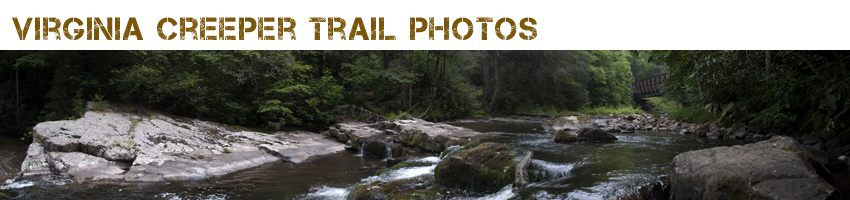
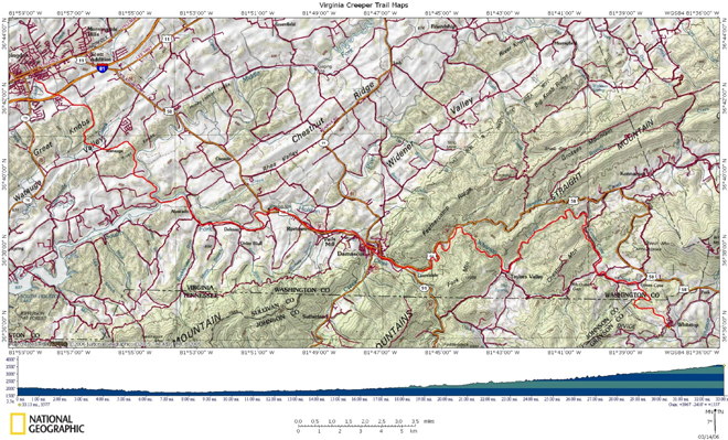
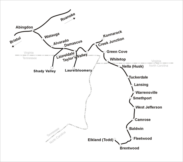
Today the rail bed from Abingdon, VA to the North Carolina State has been converted into a trail for hiking, biking and horseback riding. A plan exists for converting the old rail bed from Whitetop into Lansing, NC is stalled by a few landowners.

A hiking trail from Damascus to Laurel Bloomery has been started in places. The old rail bed from Todd, NC to Baldwin has been paved and serves as a one lane road. Many people use this road to hike and bike, but be careful, cars can use this road as well. One of the depots is still standing at Fleetwood. The depot at Todd has been restored and is in use as as a canoe outfitters. The depot was moved from its original site to the present day location and features a diesel engine from the 1950's era..

Header photo is from bridge 21 near Straight Branch